3 May 2016; Muckross House

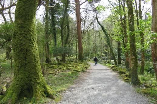
Today we visited Muckross Estate comprising Muckross House and its associated gardens located a few kilometres from the centre of Killarney and fully contained within the larger Killarney National Park.

Killarney National Park (i)
Muckross Estate
Muckross Estate
Muckross House
Muckross House

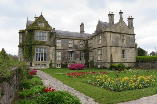
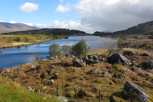
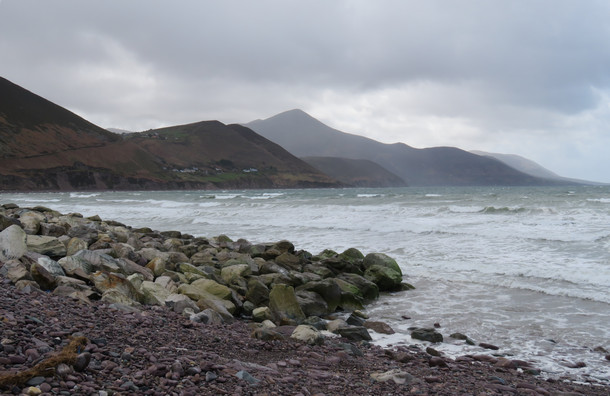
Muckross House is a nineteenth century Victorian mansion set against the stunning beauty of Killarney National Park. The house stands close to the shores of Muckross Lake, one of Killarney’s three lakes.

Muckross House was built for Henry Arthur Herbert and his wife, the water-colourist Mary Balfour Herbert. This was actually the fourth house that successive generations of the Herbert family had occupied at Muckross over a period of almost two hundred years. Building commenced in 1839 and was completed in 1843.

Muckross House
Muckross House

During the 1850s, the Herberts undertook extensive garden works and building renovations in preparation for a visit by Queen Victoria in August of 1861. Our tour guide said that this work took six years to plan and implement – and Queen Victoria stayed a total of two nights on the estate. Apparently, this investment was a significant contributing factor to the subsequent financial failure of the family leading to them having to sell the estate under circumstnces of ignominous bankruptcy. The anticipated royal largesse for this investment (a title) never eventuated for within a few months after Queen Victoria’s visit, her beloved consort, Prince Albert, died (on 14 December 1861) and Queen Victoria entered a long period of mourning and withdrew from many of the affairs of state – like conferring titles.

Torc Waterfall
Torc Waterfall
Killarney National Park (ii)

Our accomodation in Killarney was one of a number of rooms above a pub right in the centre of Killarney town. We arrived on Sunday of the May Day long weekend. Apparently Killarney has a car rally over this long weekend every year and while we had booked far enough in advance to secure accomodation – parking was another issue. And then there were the groups of young men driving their cars through the narrow streets revving their engines and leaning out of the windows with bottles of beer seeking to attract the attention of the numerous groups of young ladies who appeared to respond with encouraging comments whenever the engine revs went over 3,000 RPM and the exhaust systems backfired. Fortunately the young men were communicating in a language completely unintelligible to us and so we smiled back and waved.

When we checked into our room we found a couple of plastic packets in the bathroom containing ear plugs. At about 3 am I was tempted to find the packets and put the ear plugs to use as the alley adjacent to our hotel had filled with loud and very drunk people all speaking their particular version of their unintelligible dialect, at the top of their voices.

And Monday night was not much better, as there was a nightclub on the other side of the alley who were having a live band. The drums started tuning at half past ten and I had buried my head in the pillow when they began in earnest an hour later. I believe double glazing has superior audio attenuation properties over single panes of glass. I’m sure it has – but it didn’t seem to make our night pass any quieter.

2 May 2016; Ring of Kerry

“The Lord of the Rings” by J.R.R Tolkien contains a poem with the line;

Wander

Today, with due homage to the words of Tolkien and faith in our trusty GPS, we travelled The Ring of Kerry, a circular tourist route in County Kerry, south-western Ireland. Starting from Killarney it follows clockwise the N71 to Kenmare, then the N70 around the Iveragh Peninsula to Killorglin – passing through Sneem, Waterville, Cahersiveen, and Glenbeigh – before returning to Killarney via the N72. The total route is almost 180 km.

Ring of Kerry (i)
Ring of Kerry (i)
Ring of Kerry (ii)
Ring of Kerry (ii)
Ring of Kerry (iii)
Ring of Kerry (iii)

The Ring is a popular day trip and numerous bus companies offer circuits during the summer months. As the narrow roads make it difficult for tour coaches to pass, all tour buses run in an anti-clockwise direction, traveling via Killorglin first. There are many travel blogs suggesting that car drivers should travel in the opposite direction, going first to Kenmare to avoid delays caused by tour buses. Others advise traveling anti-clockwise to avoid having to pass the buses. We decided to travel anti-clockwise and didn’t have any difficulty with the three buses we encountered during the day.

Ring of Kerry (iv)
Ring of Kerry (iv)
Ring of Kerry (v)
Ring of Kerry (v) – wind and sleet not visible

We did however, have difficulty with a tractor towing a low-loader carrying a bulldozer. We were going up the incline and he was coming down. The tractor had reversed up a little to let the car in front pass but then decided he didn’t want to let me through and advanced causing me to try to reverse my car into the embankment on the right hand side of the road to create enough room for him to pass. This I did, but as he proceeded to pass me he stopped (thankfully) realizing that he wasn’t going to make it past me without rearranging the paintwork and metallic exterior on the left side of our car. And then we just sort of sat there. He couldn’t go forward and wouldn’t go backwards and I felt I was as close to the embankment as I could be. As the stalemate proceeded, the tractor driver proffered various words of encouragment (with vigour) and so prompted, I buried the car further into the embankment hoping that it was only soil beneath the grassy covering and not rocks. Having provided a further few additional centimetres of width, the tractor with the bulldozer slowly passed by. A hundred metres up the road I was able to pull over to inspect the car – expecting to see a new set of GT stripes down the left hand side to match the new bumps and scratches on the right hand side. I had visions of our insurance waiver flying away, off into the wild blue yonder. But fortune favours the brave and we emerged with no noticable damage to the car. We did, however, have elevated heart rates for the next ten minutes though.

Our transit of the Ring of Kerry otherwise proceeded without issue. We stopped for a cup of tea and a slice of cake at the island of Valentia enjoying some welcome sunshine and a pause from the wind.

1 May 2016; Cork to Killarney

Today we moved from Cork to Killarney, travelling along the N71, a road that hugs the coastline as it moves around the south-west corner of Ireland.

Somewhere around a place called Bonane, our trusty TomTom GPS directed me to leave the tarred two lane road and proceed onto a path that looked a little more off the beaten track than the earlier sections of N71 had. As the GPS had not failed me so far, and following a quick check to see how many of the eight or nine normally “visible” GPS satellites were being received, we continued as directed.

The road became narrower as it climbed up into the mist. Visibility was reduced to only a few metres. The road turned into two tracks in the grass with rocky outcrops adjacent on the right while the left hand side was not visible as it was shrouded in cloud – which was probably a good thing as I expect there was a drop off which would have made Christine very uncomfortable. The car never made it out of first gear as the incline was steep and my speed was cautious. On a number of occasions, it looked like we might have reached the peak which was a scary thing as, like being on the front of a roller coaster, you have no view of what’s ahead as you crest the top of the climb. We met one oncoming vehicle and I reversed till I was able to edge off the road among the rocks enough to let the other car go by. Fortunately, we only passed one vehicle along this path. Occasionally, shadowy movements in the mist reminded me that there were likely sheep (or creatures from the Jurassic period) lurking about.

Eventually we reached the peak of this route where the fog was not as thick and discovered a plaque naming this location as Priest’s Leap. The track down the other side was not as exciting as it had been on the way up with the gradual clearing of the mist until we reached the base of the valley.

Priest's Leap
Priest’s Leap
Foggy Foggy Dew
Foggy Foggy Dew – yes, Christine is waving from the passenger’s seat

We eventually rejoined the actual N71 and made it to Killarney without any further interesting deviations.

I expect the GPS had directed me along this goat track because it thought I needed some excitement. I know it’s routing algorithm is currently set to fastest, but I’m not convinced this path would have met that criteria.

30 April 2016; Ballycotton Cliff Walk

This morning we walked from Ballycotton village (about 40 km east of Cork) to Ballyandreen beach along a cliff track where you are flanked by meadows on one side and the ocean on the other. The walk extends over eight km on a foot worn track along the cliff face with stunning views and passes Ballytrasna beach. There are many stiles to cross on the route most of which were designed for very thin aliens from another planet.

Ballycotton (1)
Ballycotton (1)
Ballycotton (2)
Ballycotton (2)

Having reached Ballyandreen we looked for a cafe so that we might make use of the bathroom only to discover that the nearest cafe was back in Ballycotton.

Ballycotton (3)
Ballycotton (3)

And so we headed back to Ballycotton . . .

Ballycotton (4)
Ballycotton (4)

As luck would have it, we were able to locate suitable toilet facilites along the way and so arrived at Ballycotton village refreshed and ready for a hearty lunch. 🙂

Ballycotton (5)
Ballycotton (5)

During our first, self directed, international trip in 2009 we traversed the Cinque Terre along the west coast of Italy. The five small towns nestled along the edge of the Ligurian Sea with its translucent blue water were spectacular but the path between them could take a few lessons from the Irish. Today we walked a well worn path, free of charge and without impediments, maintained with steps where necessary, and fences to keep the cattle and sheep away from the tourists (or maybe it’s the other way around). In Italy one of the paths was closed and the others were little more than goat tracks AND you had to pay for the privilege of not being able to traverse the whole path. The leprechaun folk get my vote.